Regular price
£13,150.00
Sale price
£13,150.00
Regular price
£13,150.00
Osmo Pocket 4 Now Available Shop Now
EAN: 6937224133778
Need a Custom Solution for Your Business? Submit an Enterprise Enquiry
Looking to place a bulk order or explore tailored enterprise packages? Our team is here to help you find the right solution for your organisation.
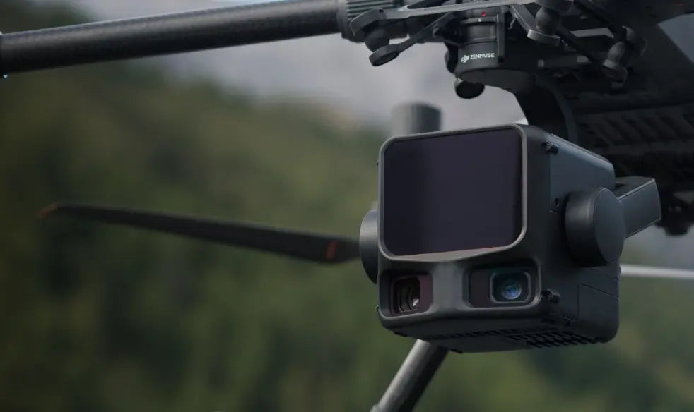
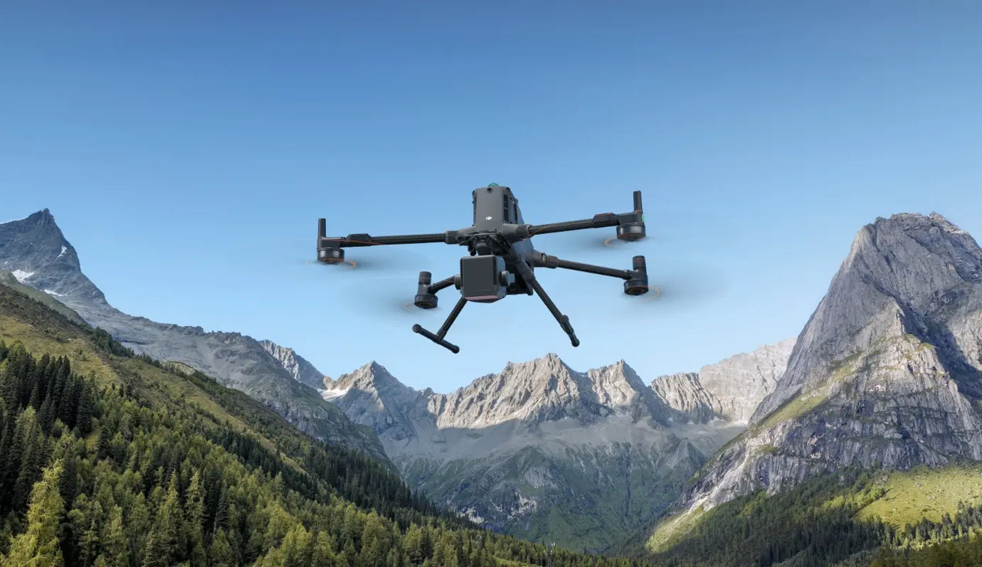
DJI's next-generation high-accuracy aerial LiDAR system features a long-range LiDAR capable of reaching up to 950 m even on objects with just 10% reflectivity. Dual 100MP RGB mapping cameras and a high-precision POS system accelerate geospatial data acquisition, enabling daily coverage of up to 100 km².
Zenmuse L3 achieves a maximum detection range of 950 m at a pulse rate of 100 kHz, tested under 100 klx ambient light and on objects with 10% reflectivity. The adjustable pulse rate allows for flexible power output and optimal adaptation to different operational scenarios. Typical flight altitudes of 300 to 500 m significantly expand single-flight coverage and boost mapping efficiency.
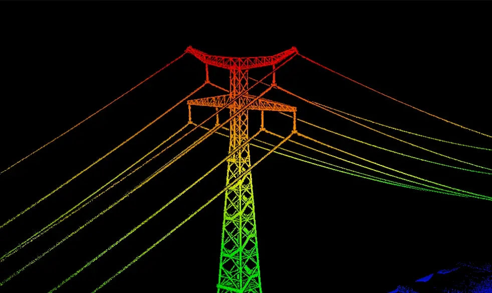
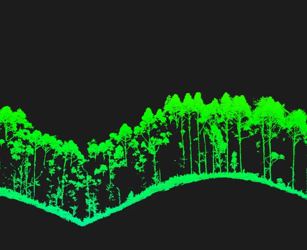
With a laser beam divergence of just 0.25 mrad (1/e²), the spot size at the same range is about one-fifth that of Zenmuse L2, enabling detection of smaller objects such as power lines and branches. Higher energy density results in stronger penetration capability, significantly increasing ground point density beneath vegetation and enabling high-accuracy reconstruction of complex terrains and structures.
With maximum laser pulse emission frequency of 2 million pulses per second and support for up to 16 returns, Zenmuse L3 delivers highly accurate spatial reconstruction. Point cloud density and penetration capability can be adjusted to fit needs from high-accuracy mapping to complex environments.
Supports Linear, Star-Shaped, and Non-Repetitive scanning modes for different operational scenarios:
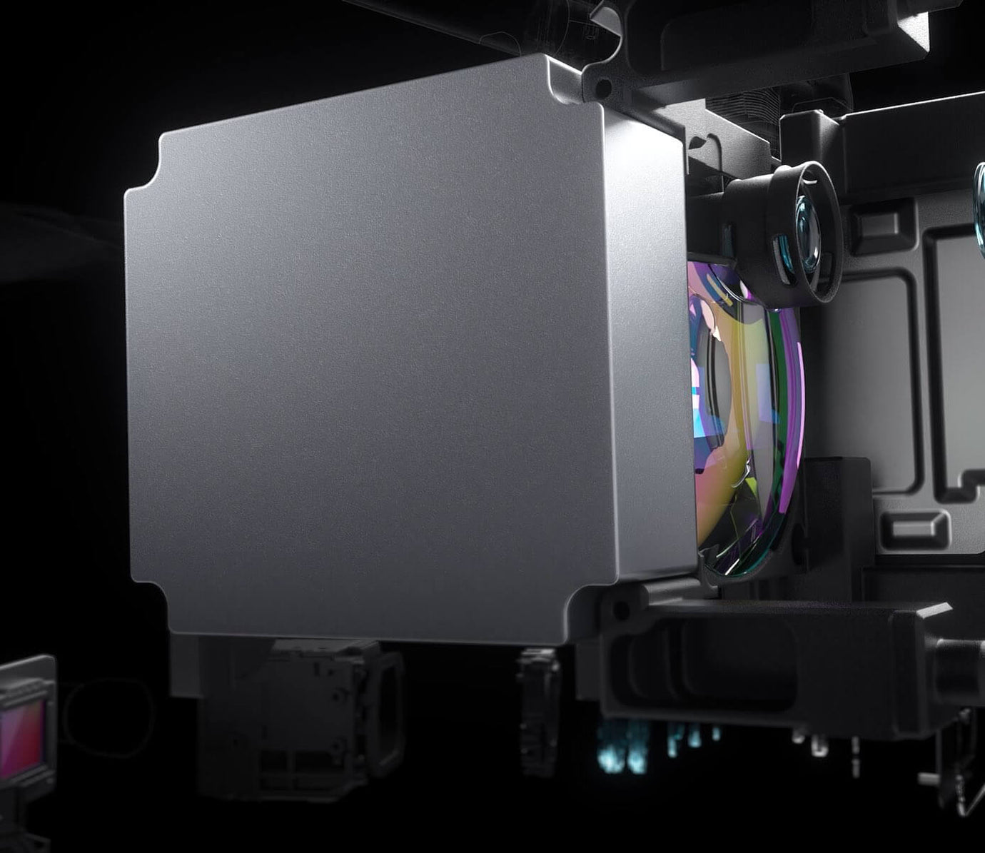
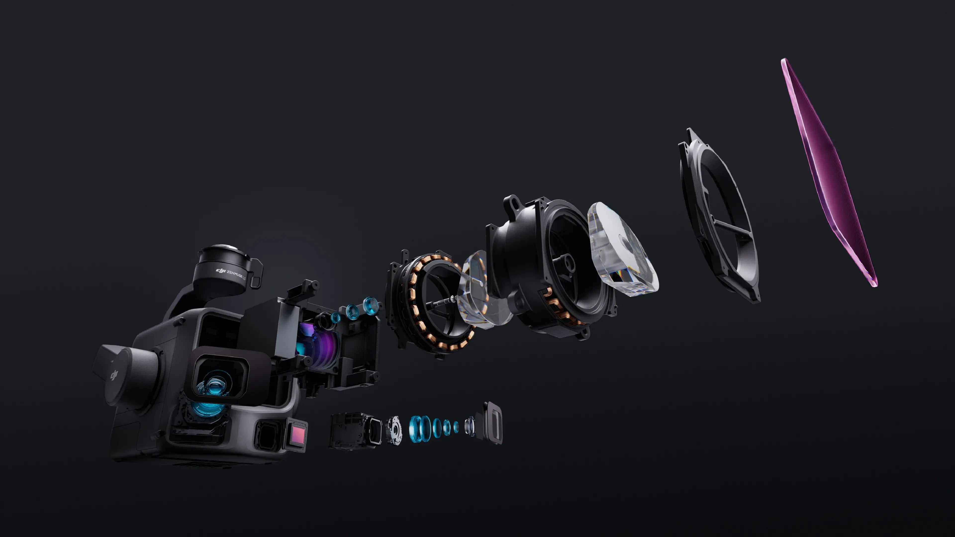
Equipped with dual 100MP 4/3 CMOS RGB sensors and a mechanical shutter, Zenmuse L3 delivers significantly enhanced accuracy and efficiency. Pixel binning supports an effective 25MP resolution with larger pixel size, producing superior color reproduction even under poor lighting conditions.
The dual RGB mapping cameras provide a horizontal field of view (FOV) of up to 107°, allowing each capture to cover a broader area. Even with a 20% LiDAR side overlap ratio, you can capture data for both digital orthophoto maps (DOM) and digital elevation models (DEM) in a single flight, thereby greatly improving operational efficiency.
The upgraded high-precision POS system achieves heading accuracy of 0.02° and pitch accuracy of 0.01° (post-processed, 1σ). The self-developed LiDAR delivers ranging repeatability of 5 mm at 150 m (1σ) and supports microsecond-level time synchronization. Each unit undergoes rigorous factory calibration to ensure consistently reliable survey results.
Vertical accuracy is better than 3 cm at 120m altitude, better than 5 cm at 300 m, and better than 10 cm at 500 m, easily supporting mapping projects at 1:500, 1:1000, and 1:2000 scales. The point cloud thickness produced by Zenmuse L3 is only half that of Zenmuse L2, supporting advanced analysis and high-accuracy applications.
With dual 100MP RGB mapping cameras, Zenmuse L3 achieves a ground sample distance (GSD) of 3 cm even at a 300m flight altitude. Real-time position synchronization enables operation without ground control points (GCPs), ensuring high-quality imagery for precise mapping.
With a smaller laser spot and higher single-pulse energy, Zenmuse L3 offers superior penetration capability. In terrain mapping and similar applications, it captures more ground points with greater completeness, significantly improving the accuracy and integrity of terrain data for precise surface fitting and reconstruction.
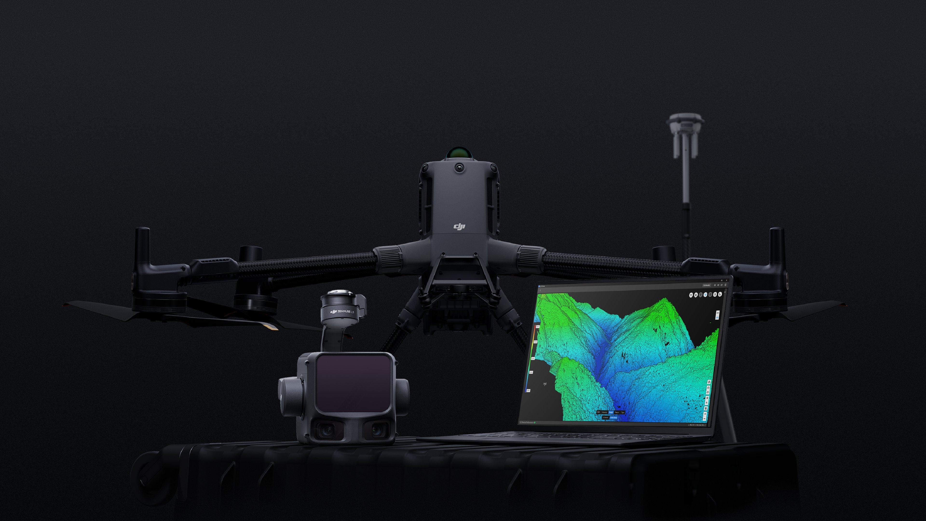
When mounted on DJI Matrice 400, Zenmuse L3 delivers outstanding efficiency. At a flight altitude of 300 m, a single flight can cover up to 10 km², enabling up to 100 km² of daily coverage
Simultaneously captures LiDAR and RGB data to generate a range of mapping products from a single flight, including DEM, DOM, and more.
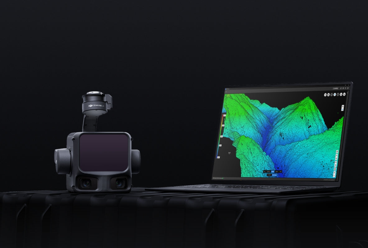
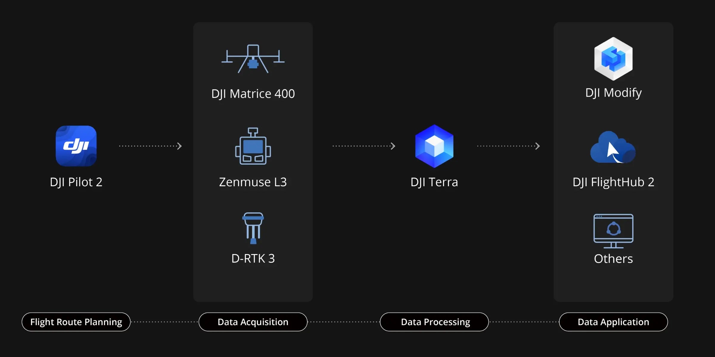
DJI Pilot 2 automatically recommends flight parameters based on user-defined routes and generates a Density Profile Chart and point cloud distribution charts before takeoff, enabling users to preview point cloud results.
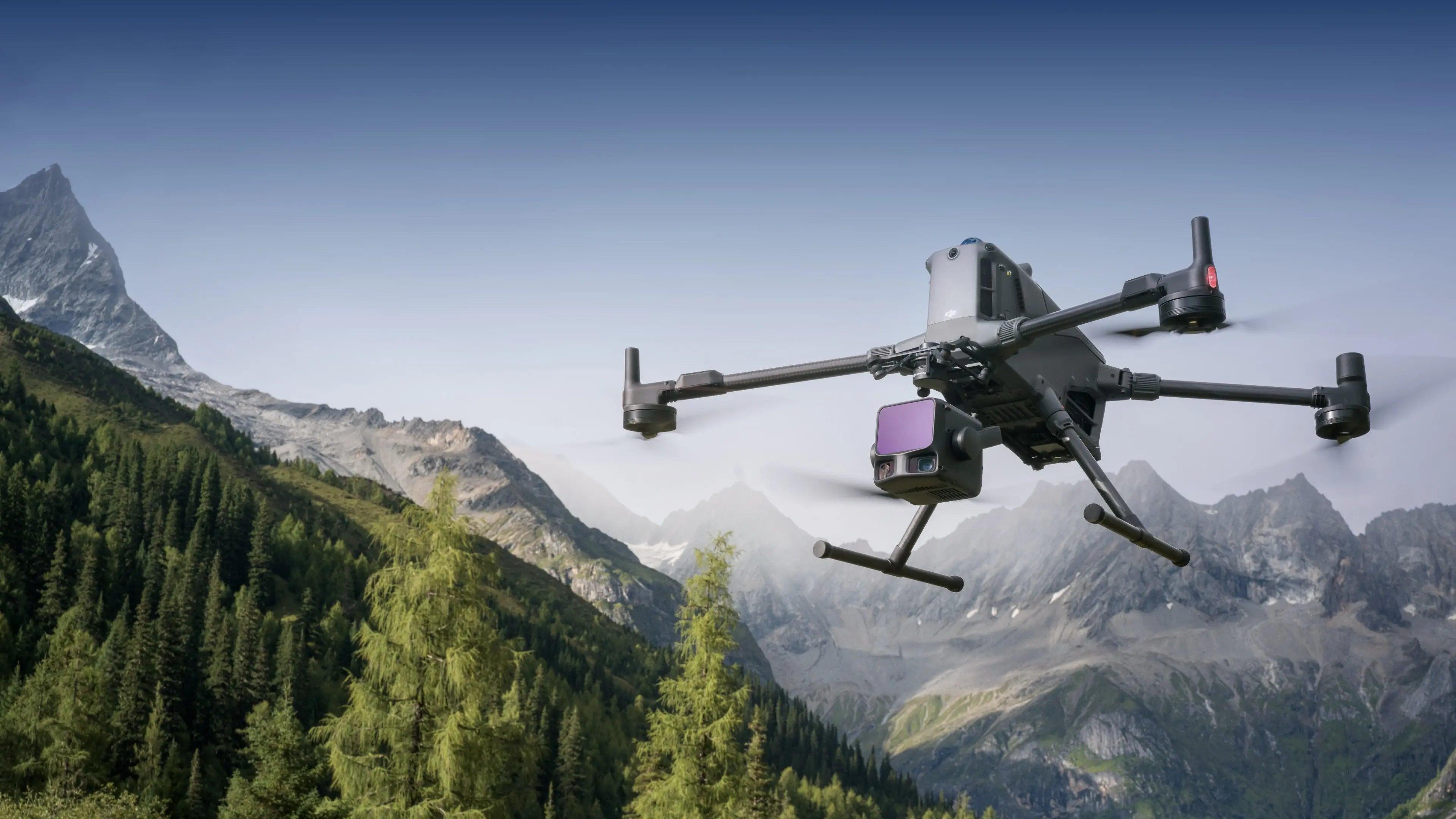
Zenmuse L3 significantly enhances Power Line Follow, supporting operations up to 130m altitude. Without bypassing obstacles or crossing lines, Zenmuse L3 enables complete electrical corridor data acquisition in a single straight flight in most scenarios.
DJI Pilot 2 supports split-screen viewing of any two data sources—point cloud, RGB, or Vision Assist—allowing users to freely combine displays to suit their needs. During Power Line Follow or when the RGB cameras face downward, Vision Assist provides real-time forward-facing visuals, reducing flight risks and improving overall efficiency and safety.
Supports real-time point cloud SLAM reconstruction with instant 2D and 3D point cloud previews during operations, allowing users to monitor progress and take measurements as data is being collected. Point cloud results can also sync instantly to the cloud via DJI FlightHub 2 for rapid emergency response and assessment.
Zenmuse L3 point cloud outputs are fully compatible with DJI FlightHub 2. Users can view and manage point cloud data in real time, easily generate detailed flight routes, annotate and share points of interest, and perform advanced line and area measurements directly in the cloud.
DJI Terra features robust built-in PPK (Post-Processed Kinematic) capabilities, compatible with D-RTK 3 and standard base station data. The platform supports local PPK for RGB imagery and LiDAR, providing centimeter-level positioning accuracy even in areas with limited network connectivity or where RTK is unavailable.
DJI Terra enables advanced Gaussian Splatting fusion-based reconstruction of point cloud and RGB data collected by Zenmuse L3, dramatically enhancing the realism and detail of 3D models. This capability broadens the application scope of LiDAR across diverse mapping scenarios and delivers higher-quality 3D model outputs.
DJI Terra enables deep integration of LiDAR and RGB data. With a single acquisition, users can simultaneously generate high-accuracy point clouds, 2D maps, and 3D mesh models. This data fusion approach significantly enhances model completeness and detail, especially in environments with complex structures such as bridges and substations. It meets the needs of industries including energy, transportation, and infrastructure.
DJI Modify supports intelligent semantic classification of point clouds, automatically distinguishing ground, vegetation, buildings, wires, electric towers, and more. After classification, users can efficiently adjust categories using Quick Selection and Structure Selection tools, further enhancing classification accuracy and processing efficiency.
DJI Modify's Profile tool allows users to flexibly select cross-sectional areas of point cloud models for intuitive analysis of terrain variation, structural features, and elevation profiles.
When paired with DJI Modify, Zenmuse L3 delivers versatile outputs. DJI Modify automatically generates a wide range of mapping products from point cloud data—including semantic point clouds, DEM, TIN, point grids, and contour lines—and supports multi-layer visualization. These outputs meet the diverse needs of engineering and design CAD-related workflows.
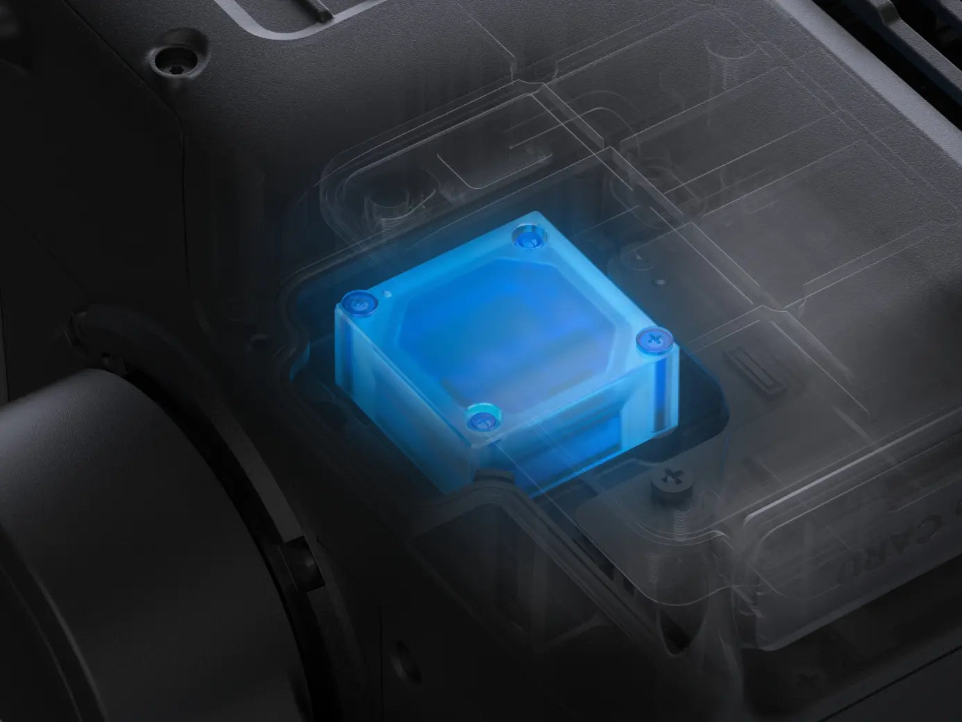
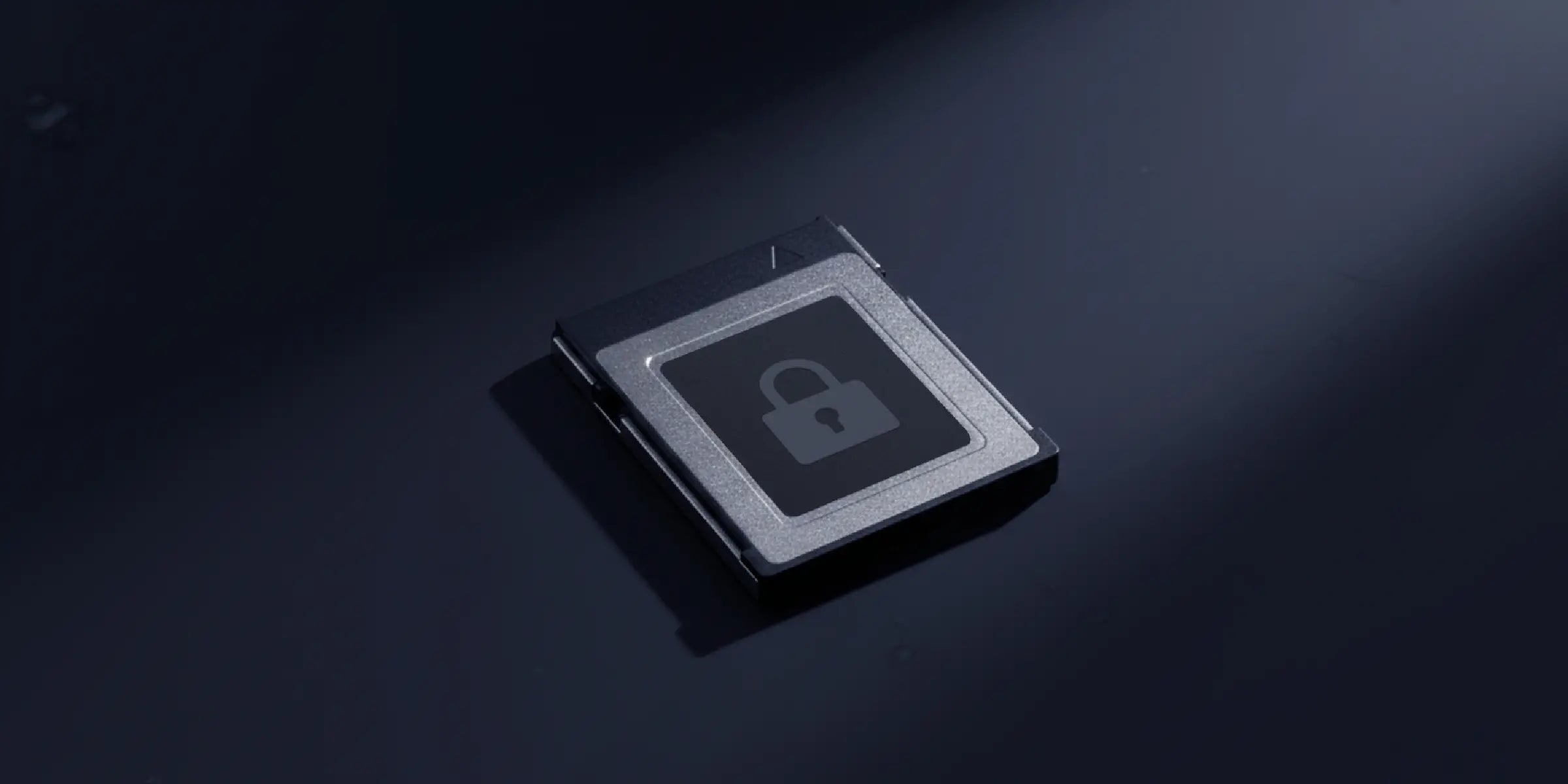
Zenmuse L3 supports CFexpress™ memory card encryption, enabling secure protection of stored data and preventing unauthorized access or data theft. Matrice 400 offers one-click log clearing and AES-256 encryption for video transmission, further ensuring data confidentiality.
Comprehensive Protection | Professional Quality Assurance | Exclusive Service | Service Starts With Activation
| System Specifications | |
|---|---|
Product Name |
|
Point Cloud System Accuracy |
|
Point Cloud Thickness |
|
Combined Horizontal FOV (Dual RGB Mapping Cameras) |
|
RGB Ground Sampling Distance (GSD) |
|
Weight |
|
Dimensions |
|
Power |
|
Supported Aircraft |
|
Ingress Protection Rating |
|
Operating Temperature |
|
Storage Temperature |
|
| LiDAR | |
Laser Wavelength |
|
Laser Beam Divergence |
|
Laser Spot Size |
|
Detection Range |
|
Wire Detection Range |
|
Ranging Accuracy |
|
Minimum Effective Detection Distance |
|
Laser Pulse Emission Frequency |
|
Number of Returns |
|
Cross-Cycle Calculation |
|
Scanning Mode and FOV |
|
Laser Safety Classification |
|
| RGB Mapping Camera | |
Sensor |
|
Lens |
|
Shutter |
|
Photo Size |
|
Minimum Photo Interval |
|
Video Specification |
|
| Position and Orientation System (POS) | |
GNSS Update Rate |
|
POS Update Rate |
|
Attitude Error |
|
Positioning Accuracy |
|
Supported PPK Differential Data Formats |
|
| Gimbal | |
Degrees of Freedom |
|
Angular Accuracy |
|
Mechanical Range |
|
Controllable Range |
|
Self-Check Method |
|
Mounting Method |
|
| Data Storage | |
Raw Data Storage |
|
Standard Memory Card |
|
Standard Card Reader |
|
| Software Ecosystem | |
Data Collection |
|
Data Processing |
|
Data Application |
|
Cloud Application |
|
Data Format |
|