Regular price
£170.00
Sale price
£170.00
Regular price
£170.00

EAN: 6937224145924
Discover our FlightHub 2 licensing options: Business plans for professional teams with scalable resources, and Enterprise solutions for demanding operations and government use. Compare features, device limits, and resource availability.
| Feature | Business Version | Enterprise Version |
|---|---|---|
| Livestream | 2000 minutes/monthLivestream time is calculated based on the total watch time of the audience. Unused livestream time will be rolled over into the following month only.
|
Unlimited durationLimited livestream minutes for dock camera: 30,000 minutes for 1-Year Plan (1 Device), 100,000 minutes for 3-Year Plan (1 Device). |
| Storage Capacity | 500 GB500GB cloud storage is available within the validity period. When storage is full, files can still be downloaded but additional files cannot be uploaded.
|
Unlimited capacity |
| Mapping Quantity | 3000 images/monthUnused quota for mapping images will be rolled over into the following month only. Images for real-time mapping and mapping based on media files share the same quota.
|
50,000 images for 1-Year Plan (1 Device), 500,000 images for 3-Year Plan (1 Device), 150,000 images for Online Device Expansion (1 Device) |
| Max Online Device Quantity | Unlimited |
Determined by the purchased basic package and device expansion package |
| Account Quantity | Unlimited |
Unlimited |
| Custom Project Roles and Permissions | ✓ |
✓ |
| Smart Search for Media Files | Unlimited |
Unlimited |
| Change Detection | Unlimited |
Unlimited |
| 3rd-Party Algorithm Integration(In Virtual Cockpit & Flight Routes) | ✓ |
✓ |
| Flight Records | ✓ |
✓ |
| Dashboard | ✓ |
✓ |
| Analyzer | ✓ |
✓ |
| Auto Dispatch Workflow | ✓ |
✓ |
| Data Sharing Within Org | ✓ |
✓ |
| Replace Logo | ✓ |
✓ |
| Custom Login Page | - |
- |
| 3rd-Party Account Login | - |
✓ |
| OpenAPI | ✓ |
✓ |
| FlightHub Sync | ✓ |
✓ |
DJI FlightHub 2 is a cloud-based drone operations management platform that brings professional aerial workflows together in one place. It provides remote drone control, intelligent flight scheduling, flexible flight route planning and management, and seamless integration with third-party platforms and systems.
Powered by advanced AI and a Multimodal Large Language Model (LLM), DJI FlightHub 2 introduces an AI agent designed to streamline AEC workflows. It enables integrated air-ground operations with centralised visual oversight and control for applications including public safety, emergency response, geospatial mapping, surveying and inspections.


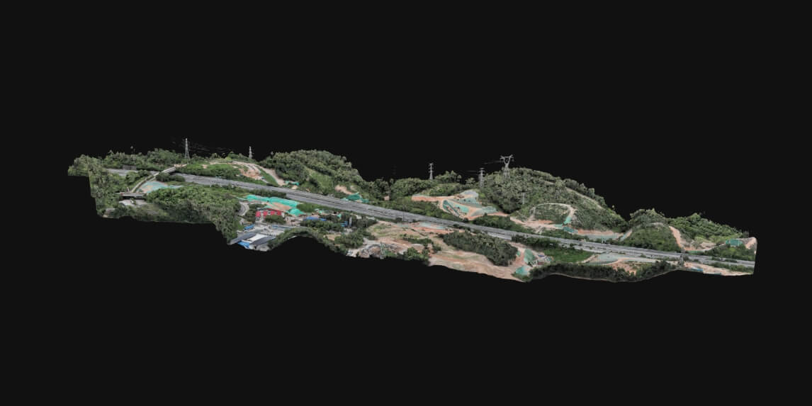
DJI FlightHub 2 enables efficient cloud-based reconstruction, generating high-accuracy 2D and 3D models or point clouds from aerial data. With compatible DJI Enterprise drones, it supports real-time 2D reconstruction during flight, with outputs meeting 1:500 scale mapping standards and exportable in industry-standard formats. Cloud Modeling capabilities, including the on-premises version, can also be integrated into existing workflows through APIs.
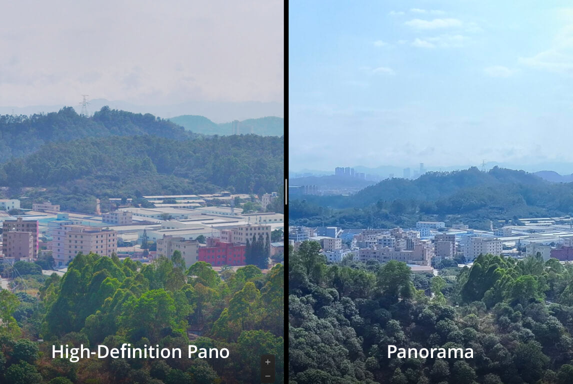
Using the telephoto cameras on the Matrice 4 and Matrice 4D Series with advanced cloud-stitching technology, users can capture high-precision aerial images and combine them into seamless panoramic views with resolutions of up to 500 megapixels.


Upon receiving an alert, FlightHub 2 supports both automatic and manual drone dispatch to a designated location. The workflow chains together three key nodes: Trigger, FlyTo Task, and Aircraft Action, making it ideal for law enforcement dispatch, emergency response, and routine patrols.

Configure automated workflows using a simple drag-and-drop interface that connects data collection, reconstruction, analysis and application stages. By integrating software and hardware, FlightHub 2 enables scheduled data capture, modelling, measurement, analysis and report generation for a streamlined end-to-end operational workflow.


| Transceiver | |
|---|---|
Weight |
|
Dimensions |
|
Ports |
|
Operating Frequency |
|
Transmitter Power (EIRP) |
|
Maximum Bandwidth |
|
Maximum Encoding Bitrate |
|
Power Consumption |
|
Power Supply |
|
Video I/O Formats |
|
Audio I/O Formats |
|
Video Transmission System |
|
Minimum Video Transmission Latency |
|
Video Coding Format |
|
Maximum Transmission Distance |
|
Operating Temperature |
|